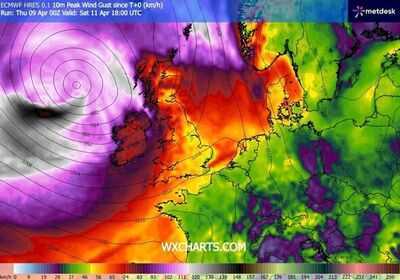
Heavy rain and strong winds are expected on Saturday, April 11, as Aintree's Grand National gets underway. The event kicks off today as much of the country enjoys warm and dry weather, but that will soon change as racing fans flock to Aintree over the weekend. Current projections from forecasting service WXCharts show rain stretching from Scotland throughout the North West of England and down to the south coast, along with winds as strong as 60mph.
More than 150,000 people are expected to attend the event over the four days it is running, with the weekend to be particularly busy. Ticket-holders should prepare for unfavourable conditions on Saturday, April 11, according to the latest weather maps. The Met Office has warned of patchy showers with some sunny spells in the region on Saturday, with similar conditions expected on Sunday, April 12. It comes after a particularly warm spell at the beginning of April, as temperatures soared into the mid-20s this week.
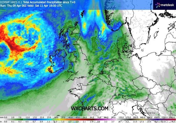
Aintree, which is located in the North West of England, close to Liverpool, is covered in rain in WXCharts' current projections. The area could experience between 0.8 and 1mm of rain per hour, according to the current forecast.
Meanwhile, the total accumulated precipitation appears to be around 7mm on Saturday. When it comes to wind, maps show peak gusts of around 60mph, which would make for blustery conditions at the event.
Elsewhere in the UK, rain will be heavier and more widespread, particularly in the south of Scotland and the Midlands. Meanwhile, winds in Scotland could reach strengths of around 80mph.
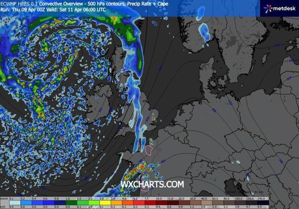
Weather maps show rain starting in the east and travelling over Britain. Heavy rain can be expected in Northern Ireland throughout the weekend.
Temperature-wise, there will be a minimum of around 7C, while the maximum temperature throughout the day will be around 10C in Aintree, so attendees should bring layers.
The Met Office's current forecast reads: "Saturday sees rain clearing east, then heavy showers and windy conditions with coastal gales north. Sunday and Monday mostly showery with sunny spells, possible thunder and temperatures near normal."
Continuing into next week, Brits can expect changeable conditions, which will be followed by "showers or longer spells of rain at times, heaviest and most persistent in the northwest together with some strong winds."
The forecast adds: "The southeast is likely to be driest and brightest. Later, conditions may become drier and more settled, especially in the north and east, but parts of the south and west may still see some showers or longer spells of rain."
-
How women's bodies bear the toll of putting others first

-
IGPL Mauritius: Teen star Veer, consistent Baisoya share lead; Amandeep, Ridhima, Milind Soni tied third with 69

-
Ian McKellen 'fell in love' with Johnny Depp on Hollywood remake set

-
KKR Sets Competitive Target Against LSG in IPL 2026 Match

-
BGT sparks record-breaking Ofcom complaints as fans ask 'Is bleeding star alive?'