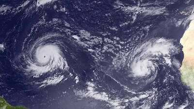
A new tropical system has emerged off the western coast of Florida, with meteorologists predicting it may strengthen into Tropical Storm Bertha as it approaches the Gulf Coast. The National Hurricane Center reported that Tropical Depression Two formed on Sunday, with its center located approximately 155 miles south of Panama City as of the 11 a.m. advisory. The system is currently moving north-northwest at a sluggish pace of 2 mph, with maximum sustained winds recorded at 30 mph.
Forecasted Movement of the System
Forecasters expect the system to continue on a slow northwestward or north-northwestward trajectory over the next couple of days before shifting westward. This path suggests that the depression will likely travel near or along the northern Gulf Coast in the coming days.
Potential Impact on Florida Residents
Residents in the watch area may start experiencing tropical storm conditions as early as late Monday. There are warnings of a possible storm surge of 1 to 3 feet along the Florida coastline, particularly from Indian Pass to Chassahowitzka. Heavy rainfall is also a significant concern, with forecasts indicating 2 to 4 inches of rain across the eastern and central Gulf Coast, affecting western Florida and extending into southern Alabama, Mississippi, and Louisiana. Isolated regions could see rainfall totals reaching up to 8 inches by Thursday, increasing the risk of flash flooding.
When Will It Be Named?
Meteorologists anticipate that the system will gradually strengthen and could officially be designated as a tropical storm by late Sunday or Monday. Current forecasts suggest it may reach sustained winds of up to 60 mph by Wednesday morning. Experts believe the storm has a higher likelihood of intensifying once it turns westward, although the degree of strengthening will depend significantly on how far offshore the storm's circulation remains. They also noted that their current track forecast leans toward the stronger end of the model guidance, but confidence remains low due to uncertainties regarding land interaction.
Local Weather Impacts Expected Soon
The National Weather Service in Tampa has issued warnings for west Central Florida and Southwest Florida, predicting gusty winds and heavy rain starting Sunday and lasting into early next week. Forecasters have indicated the possibility of strong storms with gusty winds and heavy downpours, which could result in localized flooding in streets and low-lying areas. A marginal risk for excessive rainfall has also been highlighted along the immediate west coast of Florida through Sunday night.
Overview of the 2026 Hurricane Season
This hurricane season has been relatively calm so far, with only one named storm, Tropical Storm Arthur, recorded. This storm formed in the Gulf in June and caused flooding in parts of Texas and Louisiana. If the current system receives a name, it will be called Bertha, followed by Cristobal. The 2026 hurricane season began on June 1 and will continue until November 30, with the peak activity typically occurring between mid-August and October.
-
Wealthtech Startup Veriqus Raises ₹387 Cr To Build AI-Led Investment Platform

-
US Military Faces Rising Casualties Amid Iranian Conflict

-
Rohit Sharma's Stellar Performance at Lord's Silences Retirement Rumors

-
Nurpur Police Enforce Preventive Detention Against Drug Offenders

-
Severe Flooding in Pangi Valley Following Cloudburst