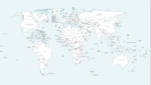
A new UN world map has sparked fresh debate in India over its depiction of Arunachal Pradesh and Aksai Chin amid competing Indian and Chinese territorial claims. The map marks the LoC in Jammu and Kashmir with a dotted line. India backed the UNGA’s “Correct the Map” resolution but stressed that its sovereign territory must be shown according to India’s official map.
A recently released United Nations world map has sparked fresh discussion in India because of how it portrays Arunachal Pradesh and Aksai Chin. The map, issued amid deliberations on the UN General Assembly’s ‘Correct the Map’ resolution, places the two areas between competing Indian and Chinese territorial claims.
The map was unveiled on July 1 during discussions linked to the UNGA resolution. In its depiction of Arunachal Pradesh, the map does not show a border between the northeastern state and Nagaland. Instead, it presents Arunachal Pradesh as a separate region, shown as sharing boundaries with Assam and China.
Aksai Chin has similarly been represented as a distinct region. The map places India along its western side and China along its eastern side. The UN has not provided an explanation for these particular cartographic changes.
What The UN Map Says About The LoC In Jammu & Kashmir
-
Libra Tarot Horoscope Today, September 13, 2026: Will Focus on Comforts, Increase Meetings and Discussions with Seniors

-
Taurus Horoscope Today, September 13, 2026: Do Not Rush in Negotiations, Avoid Taking Initiative in Contracts
-
Do these easy skincare tips at home on Hartalika Teej

-
Why people still choose marriage in a changing world

-
The strange things people collect now instead of souvenirs