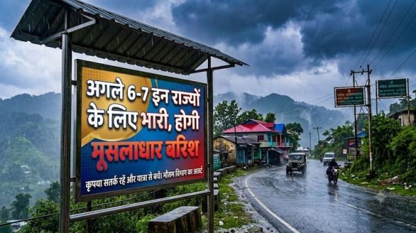
The Indian Meteorological Department (IMD) has issued a detailed and long-term weather bulletin after the southwest monsoon entered a very active phase over large parts of the country. According to meteorologists, heavy to very heavy rainfall will continue intermittently for the next 6 to 7 days in North India, Central India, North-East and Eastern coastal states. Analysis of atmospheric conditions has revealed that a distinct cyclonic circulation is present over north-west Madhya Pradesh and adjacent south-west Uttar Pradesh, while the monsoon trough line is bending southwards from its normal position, giving energy to several weather systems. Along with this, a huge amount of moisture flow from both the Arabian Sea and the Bay of Bengal is reaching the Ganga plains and the foothills of the Western Himalayas. The Meteorological Department has warned that this extreme weather pattern during the next one week will not only bring a drop in temperature, but can also give rise to serious disasters like severe waterlogging in low-lying areas, overflowing rivers, lightning and landslides on the hill slopes. Showers of disaster in Uttar Pradesh from western to eastern end: Double crisis of lightning and waterlogging. The next 6 to 7 days are going to be extremely sensitive from the weather point of view for Uttar Pradesh. According to the latest forecast released by the Meteorological Center Lucknow, yellow and orange alert of heavy rain has been implemented in more than 30 districts from the western division of the state to Awadh, Rohilkhand and Purvanchal. Saharanpur, Shamli, Muzaffarnagar, Meerut, Bijnor, Moradabad, Rampur, Bareilly, Pilibhit and Shahjahanpur may record torrential rainfall along with strong winds during the next 72 hours. At the same time, continuous showers with thunder and lightning are expected in the capital Lucknow, Kanpur, Unnao, Barabanki, Ayodhya, Rae Bareli, Amethi, Sultanpur, Prayagraj, Varanasi, Azamgarh, Ghazipur, Ballia and Gorakhpur. There is also a shadow of moderate to heavy rain in Jhansi, Lalitpur, Banda, Hamirpur and Jalaun of Bundelkhand. The Meteorological Department has expressed serious fear of lightning in the districts of Purvanchal and Terai. Farmers working in the fields have been warned to take shelter in pucca houses during intense thunderstorms, as incidents of lightning in open fields and under trees can prove fatal. Shadow of landslides on the mountains in Uttarakhand and Himachal: Rivers in spate, advisory on Char Dham Yatra. The weather pattern in the hilly states is already severe and there is no sign of relief here for the next 6-7 days. Meteorological Center Dehradun has issued 'Orange Alert' of heavy to very heavy rainfall for Dehradun, Nainital, Champawat, Udham Singh Nagar, Tehri Garhwal, Pauri Garhwal, Bageshwar, Pithoragarh and Chamoli districts of Uttarakhand. Due to continuous rains, Alaknanda, Mandakini, Bhagirathi, Pindar and Kali rivers are flowing close to the danger mark. Due to soil erosion and boulder falls on the hill slopes, there is a danger of traffic disruption at many places on Badrinath National Highway (NH-7), Kedarnath Road and Rishikesh-Gangotri Highway. The State Disaster Response Force (SDRF) and the district administration have appealed to Chardham pilgrims, tourists and local citizens not to start the journey without getting accurate weather information and completely avoid traveling at night on sensitive hilly roads. Warning of heavy rains and flash floods for the next 5 to 6 days has also been issued in Mandi, Kullu, Shimla, Kangra, Sirmaur and Chamba of the neighboring state of Himachal Pradesh. From Delhi-NCR to Central India and Northeast: Know in which states there will be a camp of clouds. There will be a camp of dense monsoon clouds in the sky for the next 6 to 7 days in the country's capital New Delhi and the cities of NCR – Noida, Greater Noida, Ghaziabad, Faridabad and Gurugram. Delhi may see several spells of moderate to heavy rain with gusty winds reaching speeds of 30 to 40 kilometers per hour, which will bring the day's maximum temperature to between 31 to 33 degrees Celsius. However, continuous showers may cause severe waterlogging and severe traffic jams on Delhi-Gurugram Expressway, Dhaula Kuan, ITO and lower underpasses. Weather disturbances will also be intense in the states of Central India and North-East: Bihar and Jharkhand: There is an alert of heavy rain and thundershowers for the next 4 to 5 days amid the already ongoing flood crisis in more than 20 districts of Bihar (Patna, Gaya, Muzaffarpur, Bhagalpur, Purnia). There will be heavy rain in Ranchi, Jamshedpur, Dhanbad and Dumka of Jharkhand with winds blowing at a speed of 40 km. Madhya Pradesh and Rajasthan: Monsoon will rain with full force in East Rajasthan (Jaipur, Kota, Bharatpur, Udaipur) and Bhopal, Gwalior, Jabalpur, Indore and Sagar divisions of Madhya Pradesh for the next 6 days. Northeast India and coastal areas: Heavy to very heavy rainfall has been predicted in Assam, Meghalaya, Arunachal Pradesh, Nagaland, West Bengal and Odisha due to the influence of monsoon winds coming from the Bay of Bengal, which may cause the water level of Brahmaputra and its tributaries to rise further. Scientific analysis of weather system: Why did this situation arise due to the confluence of cyclonic circulation and easterly winds? According to meteorologists, a complex atmospheric system is active behind such widespread and frequent monsoon rains in the first and second fortnight of September. Normally, at this time, the process of departure of monsoon starts gradually, but this year, the low-pressure systems formed one after the other in the northern part of the Bay of Bengal have completely stopped the pace of withdrawal of monsoon. At present, the cyclonic circulation centered over northwest Madhya Pradesh and southern Uttar Pradesh has extended to the lower and middle levels of the atmosphere. Along with this, a medium intensity Western Disturbance passing over the Western Himalayan region is making direct interaction with the moist winds coming from the east. When cold and dry westerly winds collide with extremely hot and humid easterly winds, severe instability is created in the atmosphere. Due to this collision, cumulonimbus clouds with high vertical expansion are developing, which are responsible for dropping huge amounts of water and severe lightning in a small area within a few hours. Scientists believe that this weather system will remain active for the next 150 to 160 hours, due to which North and East India will have to remain under constant cloud cover. Safety advisory of Disaster Management Department and Meteorological Center: How to avoid storm, water and electricity? In view of the inclement weather and especially lightning and sudden surges, the National Disaster Management Authority (NDMA) and the respective state governments have issued special safety guidelines for the citizens: Caution from lightning: If there is thunder or lightning in the sky, do not forget to stand in open fields, fields, pond banks or under tall trees. Take shelter inside a solid concrete house or a closed vehicle. Use of electronic gadgets: During a thunderstorm, disconnect the main TV, refrigerator, computer and Wi-Fi modem from the power socket. Avoid using mobile phones which are charging. Avoid traveling in the mountains: Tourists and drivers are advised not to take selfies or picnic near inaccessible river banks and waterfalls of Uttarakhand and Himachal Pradesh, as there is no chance of survival in case of flash floods. Urban waterlogging and vehicle operations: Two-wheeler drivers should be cautious of waterlogged roads and open manholes during heavy rainfall. Do not take the risk of crossing overflowing bridges, culverts and underpasses. Agricultural advice for farmers: Make sure to make arrangements for additional drainage in paddy crops. Stop spraying any kind of chemical fertilizers and pesticides in the fields for the next 5 days and take the harvested crops to a safe shed. Damini Mobile App: Rural and town citizens should keep the Government of India's 'Damini' app installed in their phones, so that their lives can be saved by getting alerts half an hour before a lightning strike.
-
Como 1907 show great class by giving Roberta Picchi a new contract after breast cancer diagnosis

-
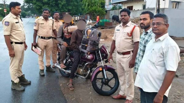
UPI trail leads to drug racket, 20 kg ganja seized in Telangana
-
My body language of touching jaw unintentional: TN CM Vijay

-
Israel to close British consulate in Jerusalem over UK sanctions

-
TN Assembly roars over CM Vijay’s claims, DMK MLAs evicted