
India's monsoon is set to remain active over large parts of the country over the coming week, with the India Meteorological Department (IMD) forecasting extremely heavy rainfall in parts of Rajasthan, Gujarat and Maharashtra on Thursday (July 24), while warning that several northern, western and eastern states could experience heavy to very heavy downpours over the next seven days. The weather agency has also flagged the risk of localized flooding, waterlogging, landslides and travel disruptions in multiple regions as a low-pressure system continues to influence weather patterns across the country.
For July 24, the IMD has forecast heavy to very heavy rainfall with isolated extremely heavy rainfall over East Rajasthan, Gujarat State and Madhya Maharashtra. Heavy to very heavy rainfall is also expected over Konkan & Goa, Odisha and West Rajasthan. Heavy rainfall is likely at isolated places across Himachal Pradesh, Uttarakhand, Jammu & Kashmir, Madhya Pradesh, Bihar, Gangetic West Bengal, Coastal Karnataka, Assam & Meghalaya, and Nagaland, Manipur, Mizoram and Tripura. Thunderstorms accompanied by lightning and gusty winds are also expected across several parts of the country, while squally conditions are likely over adjoining seas.
The weather system is expected to keep rainfall activity elevated across northwest India over the next week. Fairly widespread to widespread rainfall is forecast over Himachal Pradesh, Jammu & Kashmir-Ladakh and Uttarakhand from July 24 to July 30. Rainfall is also expected to intensify over Haryana, Delhi, Punjab and East Uttar Pradesh between July 27 and July 30, while West Uttar Pradesh is likely to receive widespread rain from July 28 onwards. East and West Rajasthan are expected to witness active monsoon conditions throughout the period, with East Rajasthan facing the most intense spell on July 24.
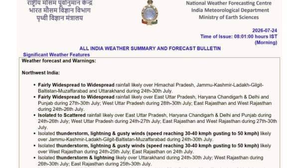
The IMD has warned that Haryana, Delhi, Himachal Pradesh, Punjab and Uttarakhand could receive isolated very heavy rainfall between July 27 and July 30. West Uttar Pradesh is expected to receive heavy rainfall from July 28 to July 30, while East Uttar Pradesh is likely to witness heavy showers from July 27 onwards. Jammu & Kashmir may also receive isolated heavy rainfall on July 24 and again between July 27 and July 30.
Central India is also expected to remain under the influence of the monsoon system. Chhattisgarh and East Madhya Pradesh are forecast to receive widespread rainfall throughout the week, while West Madhya Pradesh is expected to see active conditions during the first half of the forecast period. Vidarbha is likely to receive widespread rain during July 24-25 and again between July 28 and July 30. Heavy rainfall has been forecast over East and West Madhya Pradesh during July 24 and 25.
In eastern India, widespread rainfall is likely over Gangetic West Bengal, Jharkhand, Sub-Himalayan West Bengal & Sikkim and the Andaman & Nicobar Islands for much of the forecast period. Odisha is expected to receive heavy rainfall on July 24-25 and again between July 28 and July 30, with isolated very heavy rainfall likely on July 24. Bihar could witness heavy rainfall on July 24 and from July 27 onwards, while Sub-Himalayan West Bengal & Sikkim is likely to receive heavy rainfall during July 26-30.
Northeast India is expected to remain consistently wet. Assam & Meghalaya, along with Nagaland, Manipur, Mizoram and Tripura, are forecast to receive widespread rainfall through July 30. Arunachal Pradesh is likely to experience increasing rainfall from July 26 onwards, with heavy rainfall also expected over the state during the latter half of the forecast period.
Western India will continue to experience some of the most intense monsoon activity. Konkan & Goa is forecast to receive widespread rainfall throughout the week, with heavy rainfall expected between July 25 and July 27 and isolated very heavy rainfall on July 24. Gujarat Region is likely to receive widespread rain through July 28, with extremely heavy rainfall expected on July 24 and very heavy rainfall continuing through July 26. Saurashtra & Kutch and Madhya Maharashtra are also likely to experience heavy to very heavy rainfall during the opening days of the forecast period.
Across southern India, Kerala & Mahe, Coastal Karnataka and Lakshadweep are expected to receive widespread rainfall during much of the coming week. Heavy rainfall has been forecast over Coastal Karnataka on July 24, while thunderstorms accompanied by gusty winds reaching up to 60 kmph are likely over parts of Tamil Nadu, Karnataka and Coastal Andhra Pradesh. Telangana is also expected to witness thunderstorms and strong surface winds during the forecast period.
Alongside the rainfall warnings, the IMD has issued a flash flood outlook indicating low to moderate flash flood risk over several districts of Gujarat Region, Saurashtra & Kutch and Konkan & Goa during the next 24 hours. Areas including Ahmedabad, Surat, Vadodara, Bharuch, Navsari, Valsad, Rajkot, Jamnagar, Bhavnagar, Mumbai, Thane, Palghar, Raigad and Ratnagiri may experience surface runoff and inundation in low-lying areas because of expected heavy rainfall.
The weather agency has cautioned that heavy to extremely heavy rainfall could result in urban flooding, waterlogging, reduced visibility, disruption to traffic, localized landslides, as well as possible riverine flooding in some catchments. People have been advised to check traffic conditions before travelling, follow local advisories, avoid waterlogged areas and refrain from staying in vulnerable structures during periods of intense rainfall.