Bhubaneswar: The India Meteorological Department has issued a nowcast warning for 12 districts of Odisha, including state capital Bhubaneswar, till 2 pm on Thursday.
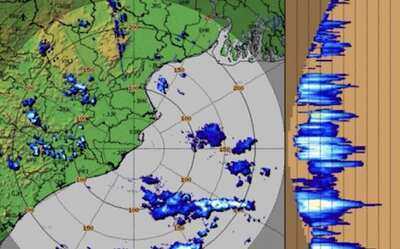
Thunderstorm, lightning and Light to moderate rain with wind speed reaching 40 kmph may occur at one or two places in the district of Anugola, Dhenkanal, Nayagada, Kendujhar, Jajpur, Kataka, Khordha (including Bhubaneswar city), Puri, Ganjam, Boudh, Kandhamala and Mayurbhanj in three hours.
People have been advised to keep a watch on the weather for worsening conditions.
The warning has come with a seasonal trough running across Odisha. A cyclonic circulation also persists over Northwest Bay of Bengal off north Odisha coast. Under its influence, a low-pressure area is likely to form over northwest Bay of Bengal & neighbourhood around July 3.
While some parts of Odisha started experiencing heavy to very heavy rainfall activity from Wednesday. Light to moderate rains or thundershower activity is likely to occur at most places, while very heavy rainfall may prevail at some places in the state from July 2-6.
On June 1, heavy downpour since early morning inundated several parts of Bhubaneswar, leading to waterlogging on roads and affecting vehicular movement in several localities.
On June 2-3, orange warning of heavy to very heavy rain has been issued for the districts of Mayurbhanj, and Koraput, and yellow alert sounded for Baleshwar, Sundargada, Sambalpur, Debagada, Anugola, Kendujhar, Nabarangpur, Rayagada, Malkangiri, and Gajapati districts.
The IMD has advised residents of the affected districts to remain alert and take necessary precautions in view of the possibility of adverse weather conditions. Authorities have also urged people to avoid venturing into waterlogged areas and to stay indoors during thunderstorms.
-
Football Quizzes and Trivia Challenges

-
Tillman’s Free Kick Secures 10-Man United States’ Victory over Bosnia and Herzegovina

-
A Decade into F1, Charles Leclerc Aims to Regain His Competitive Edge

-
Lamborghini Urus SE Performante: The 801-HP Plug-in Hybrid SUV That Redefines Performance

-
Fiat Introduces Multiplina Concept – A Compact Electric Revival Inspired by the Iconic 500