The India-Nepal boundary dispute is not the story of two hostile nations. It is something more complicated: a close friendship strained by history, geography, and an inherited ambiguity that neither country created but both must now resolve.
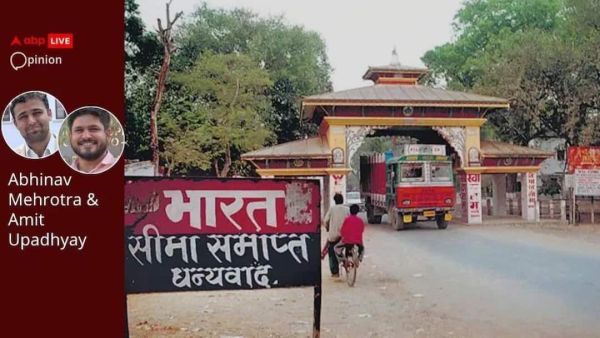
The two neighbours share more than 1,751 kilometres of open border, where people cross freely, families intermarry, and cultures have blended for centuries. Yet, despite this intimacy, they remain unable to agree on exactly where one country ends and the other begins.
The Colonial Origins Of Dispute
The trouble begins, as so much trouble in South Asia does, with a colonial treaty. The Treaty of Sugauli, signed in 1816 after the Anglo-Nepalese War, established the Kali River as the western boundary between Nepal and British India.
What appeared straightforward on paper proved far more complicated in practice. Nepal argues that the river originates at Limpiyadhura, which would place Kalapani and Lipulekh within its territory. India maintains that the river's source lies near Kalapani, placing the disputed area within Uttarakhand.
Both sides rely on competing maps, historical records, and interpretations of the treaty. Neither has shown any willingness to yield ground—either territorially or diplomatically.
Why Kalapani And Lipulekh Matter
India's presence in the area strengthened after the 1962 Sino-Indian War, and it has maintained administrative and military control there ever since, citing strategic security concerns along the Himalayan frontier.
Lipulekh Pass also serves as an important route for the Kailash Mansarovar Yatra and facilitates trade with Tibet, giving it considerable geopolitical significance. For New Delhi, the area is a sensitive security zone near the India-China border. Nepal, however, contests India's control over the region and maintains that the territory, including Kalapani and Lipulekh, falls within its sovereign boundaries.
Decades Of Dialogue, Limited Progress
Efforts to manage the disagreement have not been lacking. A Joint Technical Level Boundary Committee was established in 1981 to identify and restore boundary pillars along the India-Nepal border.
The committee reportedly clarified approximately 98 per cent of the boundary, leaving the disputes at Kalapani and Susta unresolved when its mandate concluded in 2008. It was subsequently agreed that these issues would be addressed through higher-level diplomatic engagement, including Foreign Secretary-level discussions.
A Boundary Working Group was later established in 2014, although progress on the disputed sectors has remained limited. While institutional mechanisms for dialogue exist, the unresolved status of the disputes highlights the continuing political and diplomatic challenges involved in achieving a mutually acceptable settlement.
New Political Flashpoint In Kathmandu
The dispute returned to the political forefront after Balendra Shah assumed office on March 27, 2026, following the electoral victory of the Rastriya Swatantra Party.
In his first parliamentary address as Prime Minister, Shah observed that border-related encroachment issues existed on both sides of the India-Nepal frontier, stating that Nepal had also occupied Indian territory in certain locations.
The remarks generated significant criticism from opposition politicians and former diplomats, who questioned the basis of the statement and demanded its withdrawal. Nepal's Foreign Ministry later clarified that the Prime Minister was referring primarily to instances of "cross-border occupation" arising from fixed river-boundary demarcations, where citizens of one state cultivate or occupy land situated within the territory of the other.
The ministry also stressed that Nepal's formal territorial claims remained unchanged.
UK Maps Question And India's Response
The Prime Minister also proposed seeking assistance from the United Kingdom and China in resolving the dispute.
Nepal's interest in the UK relates specifically to accessing original British survey maps from the early nineteenth century, some dating to 1827 and 1834, which could strengthen its negotiating position regarding the source of the Kali River.
This is not a call for mediation in the formal sense but rather a request for access to historical records held by the custodian of the colonial cartographic archive.
India's Ministry of External Affairs responded promptly, stating that bilateral mechanisms already exist to address all aspects of boundary-related issues and making clear that there is no role for third parties in a bilateral matter between India and Nepal.
China's Growing Relevance To Issue
China has added another dimension to the dispute.
During Chinese Foreign Minister Wang Yi's visit to New Delhi in August 2025, India and China agreed to reopen border trade through Lipulekh Pass as part of broader efforts to improve bilateral relations.
Nepal subsequently sent diplomatic notes to both governments, reiterating its claim that Limpiyadhura, Lipulekh, and Kalapani form part of Nepal under its interpretation of the 1816 Sugauli Treaty.
India rejected Nepal's objections, maintaining that trade through Lipulekh has existed since 1954 and describing Nepal's territorial claims as unsupported by historical evidence.
The episode echoed the controversy that followed the 2015 India-China agreement concerning Lipulekh, which Nepal also opposed. From Kathmandu's perspective, bilateral arrangements involving territory claimed by Nepal raise concerns about sovereignty and exclusion from decisions affecting a disputed area.
More Than Cartographic Disagreement
What this dispute ultimately reveals is not merely a cartographic problem but a political one: the gap between the relationship India and Nepal celebrate and the one they sometimes practise.
The two countries remain bound by deep cultural ties, an open border, extensive economic interdependence, and decades of people-to-people contact. Nearly 98 per cent of their roughly 1,751-kilometre boundary has already been agreed upon, leaving only a handful of disputed sectors unresolved.
Yet symbols matter. Every road inaugurated near a contested pass, every map revised to reinforce a territorial claim, and every bilateral arrangement concerning disputed territory erodes a reservoir of trust that neither side can afford to lose.
The Road Ahead
The path forward is unlikely to emerge from international mediation or grand diplomatic spectacles. It will require sustained political engagement, joint technical surveys, and a willingness among leaders in both New Delhi and Kathmandu to prioritise a durable settlement over short-term nationalist advantage.
A settled border would serve the interests of both countries far more effectively than a perpetually contested one. The challenge is whether they can summon the patience and political courage necessary to resolve a dispute inherited from history rather than continue managing it indefinitely.
Abhinav Mehrotra is an Associate Professor and Assistant Director, and Amit Upadhyay is an Associate Professor and Senior Fellow at Jindal Global Law School, O.P. Jindal Global University.
[Disclaimer: The opinions, beliefs, and views expressed by the various authors and forum participants on this website are personal and do not reflect the opinions, beliefs, and views of ABP News Network Pvt Ltd.]
-
US-Iran Deal Explained: What Trump's Proposed Agreement Means For Nuclear Talks

-
German Court Holds Google Responsible For Fake AI Responses

-
Bhopal Man Arrested Over Alleged Links To Pakistan-Based Radical Network

-
DRDO Tests Ballistic Missile Interceptors, Naval Strike Missile In Key Milestone
-
Artificial lights might be causing kites in Kerala to hunt at night