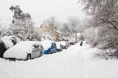
It's been a cold, wet and windy weekend for much of the UK and more snow is set to return before next weekend according to the latest Met Office weather maps. The forecaster has mapped snow hitting the UK on Friday, April 10, with Northern Ireland affected first from 7am, followed by Scotland and then England by 1pm.
It follows days of weather warnings over Easter weekend thanks to Storm Dave, which warned of potential blizzard conditions in Scotland and driving 80mph winds in England. This coming Friday, snow is forecast to return for parts of the UK as the recent cold snap continues to pile on the pressure.
As many as 18 areas of the UK spanning all four constituent countries are facing the risk of snow by Friday.
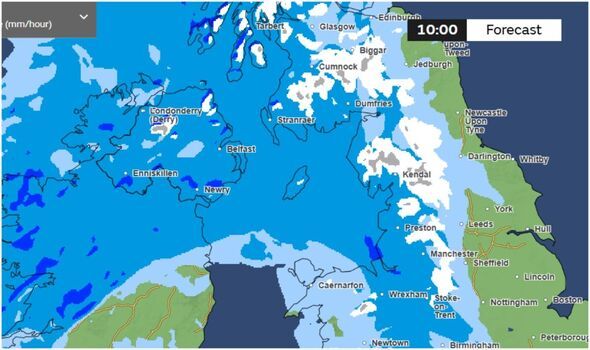
Areas of England including Kendal in Cumbria, Stoke on Trent, Manchester, parts of North Yorkshire and Derbyshire are all expected to see snow by 1pm on April 10. It follows snow arriving in Northern Ireland from 7am on Friday, and snow across most of Scotland by 10am the same day.
Several areas of Scotland including Dumfries, Cumnock, Stranraer, Strathyre and Fort William will also see snow, while in Wales, Wrexham could be affected. In Northern Ireland, Londonderry, Belfast and Enniskillen could see snow too.
The full list of major areas which could see snow before Friday, based on the Met Office snow maps is:
The Met Office said in its longer term forecast from Friday April 10: "Changeable with Atlantic frontal systems moving across the UK at times. These will bring spells of unsettled weather, with showers or longer spells of rain and a risk of strong winds. The wettest conditions will probably be in the northwest of the UK, with a risk of snow on high ground in the north. Drier and brighter interludes with lighter winds will develop between frontal systems. Temperatures are expected to be close to average overall, perhaps with some colder spells in the north and warmer conditions in the south at times."
-
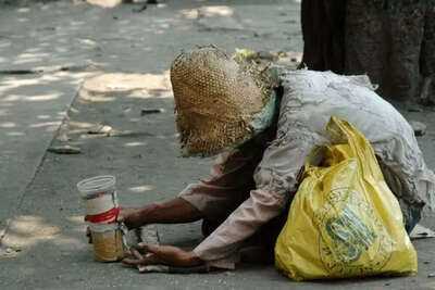
Surprising Case of a Wealthy Beggar in Chhattisgarh
-
Shocking Discovery: Body Found in Blue Drum in Rajasthan

-
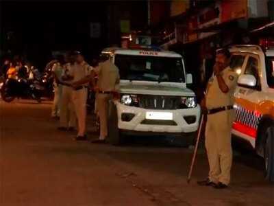
Police detain five after clash between two groups in Mumbai's Malad
-
Uttar Pradesh is most fortunate to have largest youth energy: CM Yogi Adityanath
-
Free summer horse racing tickets to give away with Arena Racing Company